Enhancing business operations and data accuracy with Mosaic’s high-resolution image solutions – in 7 unique ways

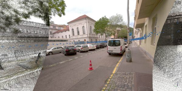
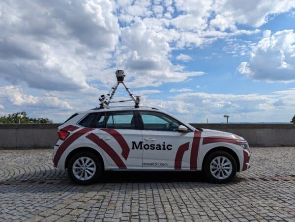
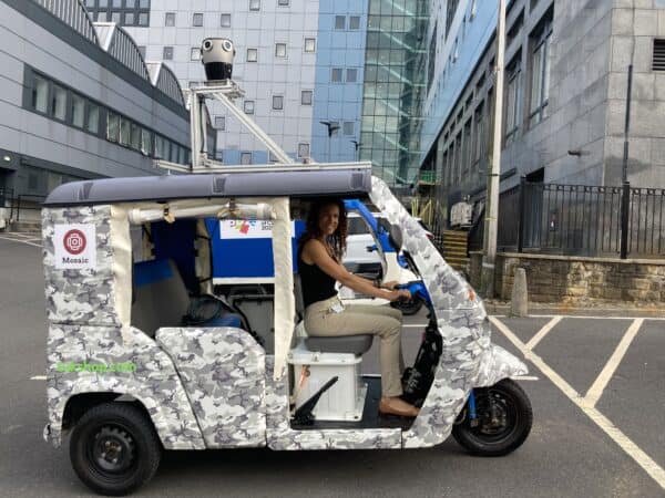
In the rapidly evolving field of mobile mapping, Mosaic Camera Systems have made waves as the premier solution for capturing high-resolution imagery and precise geospatial data in one standalone unit. Unlike traditional mobile mapping methods, Mosaic cameras offer unparalleled versatility and efficiency, capable of operating independently or in concert with other mobile mapping sensors and systems.
These innovative units integrate seamlessly into various applications, from urban planning and infrastructure maintenance to disaster response and environmental monitoring. They enable users to collect detailed 360º imagery and geospatial data encompassing roads, buildings, vegetation, and more, all while on the move. This integrated approach not only streamlines data collection processes but also elevates the quality and utility of the geospatial data captured.
The ability to function as both standalone units and in tandem with other sensors makes them uniquely flexible and powerful in the field of mobile mapping.
Discover how seven distinct users are leveraging Mosaic Camera Systems to redefine their data collection methods and enhance how they, or their clients, utilize this data for improved decision-making and operational efficiency.
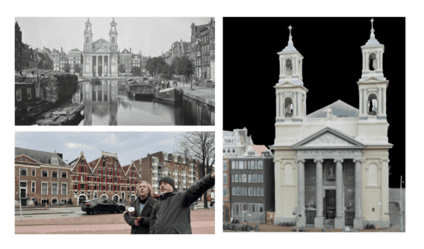
Mapping data isn’t all about private profits! How it brings relief.
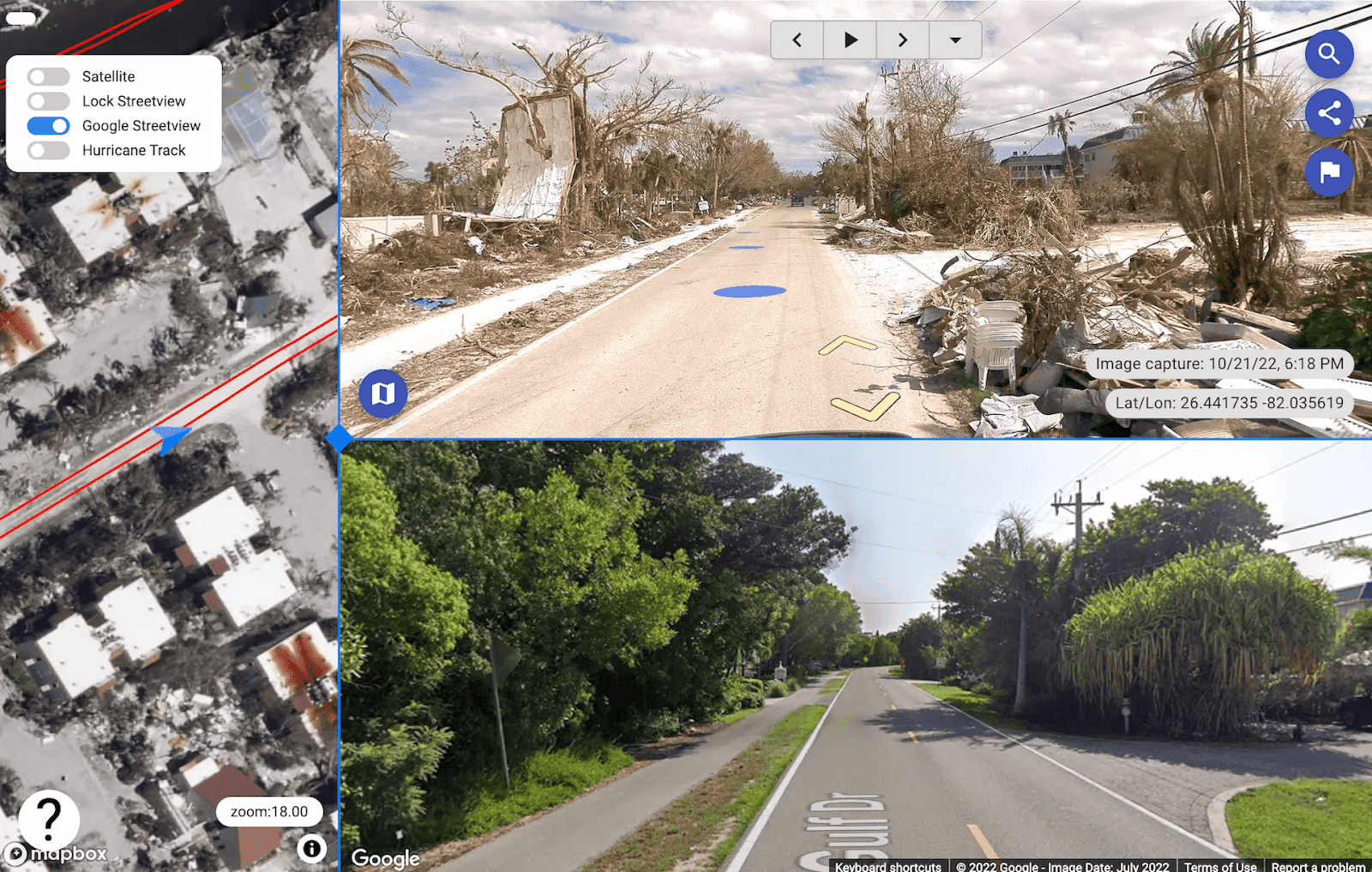
While many surveying and mapping companies are for-profit companies, there are many that provide vital services in emergency situations, including post-disaster data capture. Near real-time street view collected in the aftermath of a large storm or other natural disaster can provide emergency response teams with the on-the-ground data they need to react appropriately. This can mean knowing where to send debris removal trucks to communities that are blocked off or provide food and water to those who might not have access to such necessities.
Being able to collect, process, and visualize the data quickly is of the utmost importance. Check out how this is done with mobile mapping systems and solutions here.
When mobile mapping extends beyond roads to ensure safe rail travel
The Norwegian rail authorities require precise track location data, accurate within 10 mm horizontally, to be gathered annually. This monitoring aims to quantify track displacement due to factors like temperature fluctuations and heavy train braking, as excessive movement might lead to derailments. Hence, meticulous tracking of these shifts holds paramount significance. Railway lines need to adhere to such stringent restrictions in order to ensure that passengers and cargo arrive safely at their final destination.
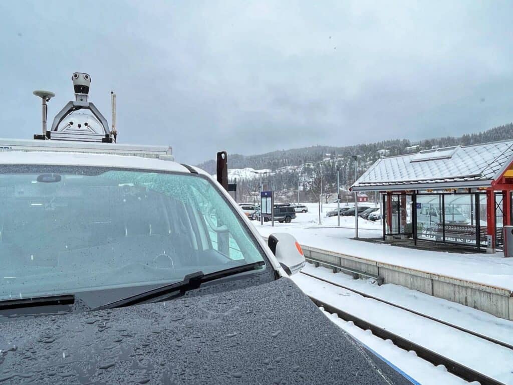
Field, a Norwegian company and leader in surveying, utilized a new mobile mapping solution to cut a project from a 6-month long campaign to only 10 days of data capture and about 4 to 5 weeks of data processing and quality control. Learn more about how they did so here.
Mapping data isn’t only about man-made assets! How it green-ifies our cities
greehill is an innovative green-minded startup with the goal to “Keep your city’s trees healthy, safe, and resilient and management costs low.” They offer the world’s first Smart Tree Inventory.
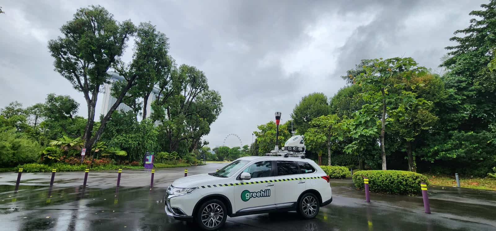
By capitalizing on the power of their mobile mapping system, which contains some of the most advanced technologies in the world for street view data capture, they capture data that is later analyzed by their one-of-a-kind algorithm that can determine failure risk, safety factor, leaf area, disease, and more. The Digital Twin created by Riegl LiDAR data meticulously replicates each tree, while high-resolution photos captured with a Mosaic camera provide different ranges, angles, and altitudes of each tree.
Their mobile mapping efforts are helping clients from Singapore to Texas to Italy:
- Reduce lifetime cost of trees
- Streamline maintenance and operations
- Automate data analysis, evidence-based reporting, and real-time intervention management
See how urban vegetation mapping, planning and maintenance is leading to a greener, cleaner world.
Midwest Energy’s leap forward with 360° camera technology
Midwest Energy & Communications, renowned for their reliable electric services, recently faced a challenge in their utility mapping and surveying process. The need for detailed, up-to-date street view imagery was crucial for their infrastructure development, especially as they ventured into expanding fiber internet services. Traditional methods relying on external data sources offered limited control over quality and timeliness, hindering their infrastructure planning.
To overcome this, Midwest turned to the Mosaic X camera, leveraging its advanced 360º street view imagery to revolutionize their approach. The camera’s high-quality, detailed imagery became a game-changer, providing the precise, in-house data collection they needed. This not only enhanced their immediate mapping needs but also set the stage for future advancements in data analysis and machine learning applications. The Mosaic X camera’s transformative impact is a testament to Midwest’s innovative spirit and commitment to a more connected and data-driven community.
Read more about the original case study here.
How a Dutch surveying company overcame industry challenges with Mosaic X Mapping Technology
Kavel 10, a leading surveying company in the Netherlands, faced a significant challenge in capturing precise, high-quality data for their engineering and municipal projects. Their previous systems, including various panoramic cameras, were hampered by low resolutions, rolling shutters, and complex interfaces, leading to operational inefficiencies and data inaccuracies.
The breakthrough came with the adoption of the Mosaic X camera system, which is compatible with RIEGL’s line of Mobile Laser Scanning Systems. This advanced mapping solution addressed the core issues Kavel 10 faced, offering high-resolution imagery, global shutters, and a user-friendly interface. It transformed their data collection process, enhancing the accuracy and detail of their surveying work. The camera’s robust design and internal storage streamlined operations, enabling Kavel 10 to efficiently manage extensive data across numerous projects, including city initiatives and infrastructure-based assignments.
Watch Ewoud Van Der Cruyssen from Kavel 10 share his insights on the benefits of using Mosaic Camera System on YouTube:
The integration of Mosaic’s high-resolution cameras with RIEGL’s precision Mobile Laser Scanning Systems represents a groundbreaking development in the mobile mapping industry. This collaboration combines Mosaic’s expertise in producing state-of-the-art 360º cameras, like the Mosaic X, with RIEGL’s acclaimed mobile laser scan technology, renowned for its accuracy and performance. The synergy between Mosaic’s advanced imaging capabilities and RIEGL’s laser scanners enables customers to capture comprehensive, detailed data and imagery, enhancing applications in surveying and urban planning.
This integration not only broadens the scope of mobile mapping solutions but also offers customers the dual benefits of high-resolution photo-realistic imagery and precise, dense, feature-rich data. As a result, users can enjoy an enriched data set that significantly improves infrastructure assessment, project planning, and decision-making processes, illustrating the profound impact of combining leading-edge technologies in mapping and geospatial analysis.
This technological upgrade led to remarkable improvements for Kavel 10. They experienced significant operational benefits, including enhanced data quality, reduced manual interventions, and more efficient project execution. The Mosaic X’s stability and reliability were particularly crucial for highway operations, ensuring continuous data collection without interruptions. The newfound efficiency and precision in data capture and processing enabled Kavel 10 to deliver more accurate and reliable services, fostering their growth and expanding their impact in surveying and municipal planning.
Discover the full original story here.
Transforming urban mapping with advanced technology: The Mapersive Story
Mapersive, a pioneering SaaS provider, alongside Geomatic, a leading GIS company and the exclusive ESRI distributor in Morocco for over 30 years, faced significant challenges in efficiently capturing up-to-date, high-quality geospatial data, crucial for effective urban planning and infrastructure maintenance. The traditional methods were not only time-consuming but often yielded data that lacked the necessary detail and timeliness. This limitation posed a significant barrier, particularly in areas such as surveying, GIS, urban planning, and infrastructure maintenance.
The introduction of advanced 360° mapping cameras marked a turning point for both companies. These cameras provided high-resolution, accurate geospatial data, leading to a drastic transformation in their approach to urban mapping and data analysis. The implementation led to substantial improvements in time efficiency and data quality, with clients experiencing a marked reduction in time for data capture and processing. This technological leap enabled more strategic urban infrastructure maintenance and elevated Mapersive’s customers’ capabilities in urban planning and GIS, showcasing the impactful role of advanced mapping technologies in enhancing operational efficiency and shaping the future of urban development.
You can learn more about the original case study here.
Enhancing telecom surveying: A case study in operational efficiency
In the dynamic field of telecom surveying, Catsurveys, a prominent UK surveying company, faced the challenge of swiftly and accurately capturing extensive asset data crucial for their project life cycles. Their journey towards embracing advanced technology led to a significant operational transformation. By integrating several Mosaic camera systems into their workflow, Catsurveys achieved remarkable project improvements, including connecting more homes and reducing costs and lengths of self-dig operations, all while increasing overall efficiency.
The integration of these advanced mapping tools brought substantial benefits. They observed an increase in the number of connected properties and a reduction in surveying costs. This strategic adoption not only streamlined their processes but also demonstrated the potential of modern mapping technology in surveying. The use of these advanced cameras, provided Catsurveys with detailed, precise, and timely data, enabling better project management and execution. This transition highlights how embracing innovative mapping solutions can lead to enhanced operational efficiency, cost reduction, and improved project outcomes in the telecom surveying industry.
Don’t miss out on all of the details here in Catsurvey’s case study.
Watch the video case on YouTube: