
Mosaic cameras across the globe: Navigating global mapping landscapes
Let’s explore the global impact of Mosaic’s transformative 360º mobile mapping cameras and uncover success stories across diverse industries and geographical locations.
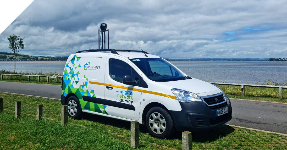
- United Kingdom – Catsurveys – Telecom surveying
- Prague – Netflix/Scanline Studios – VFX
- Scandinavia – Field – Municipality mobile mapping
- Florida, USA – SiteTour360 – Post disaster mapping
- California & Florida, USA – WGI – Road infrastructure surveying
- Utah, USA – Sevier County rural road mapping
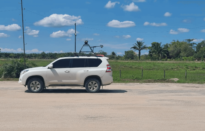
- Singapore, USA, Europe – greehill – Green space management
- Morocco – Geomatic/Mapersive – Urban Planning
- Michigan – Midwest Energy & Communications – Innovative utility mapping
- Netherlands – Kavel 10 – Utilizing imagery and RIEGL LiDAR for engineering data processing
- Abidjan – PLACE – Detailed urban imagery
- Colombia – Dymaxion – Electrical grid and road inspection
- Prague – SmartDelta Mobile mapping software integration
Introduction
As we find the global footprint of Mosaic, we ask, “Where in the world is Mosaic?”
These advanced 360º mobile mapping cameras have proven crucial in overcoming various challenges.
The journey of Mosaic’s transformative cameras began almost four years ago after years of ideation, meticulous design, and multiple iterations. Since our inaugural shipment, our robust and reliable cameras have traveled across the globe. As a result, they have left their mark on nearly every continent and are making significant strides in numerous countries.
Moving beyond technical details, it’s the real-world applications that truly showcase the extent of Mosaic cameras. Whether in vast landscapes or bustling urban centers, these cameras have found homes in diverse environments. Additionally, they’ve become indispensable tools across various industries.
Throughout this article, we aim to highlight the significant impact of Mosaic cameras in the past year through personal experiences and stories.
Discovering Mosaic Around the Globe
Mosaic stands at the forefront, providing innovative solutions through its advanced 360º mobile mapping cameras. For nearly four years now, Mosaic has been shipping its robust and reliable camera systems to diverse industries, making a global impact.
In this exploration, we invite you to discover a comprehensive collection of case studies that showcase the transformative journey of Mosaic cameras across companies, industries, and countries around the globe.
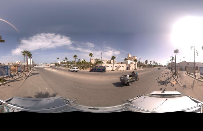
 Mosaic Around the Globe
United Kingdom – Catsurveys – Telecom surveying
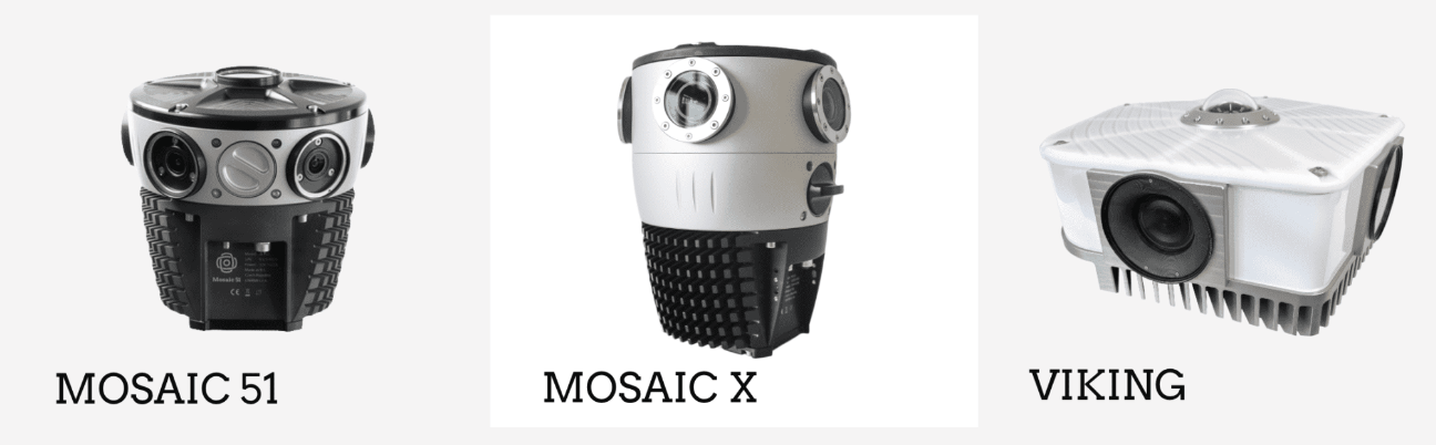
The journey begins in the United Kingdom with Catsurveys Ltd, a prominent professional surveying company. Facing challenges with their previous mobile mapping solution, including high costs and inadequate imagery for telecom surveys, Catsurveys adopted Mosaic’s 360-degree mobile mapping camera, the Mosaic 51.
The Mosaic 51 proved to be a game-changer, offering a cost-effective, scalable, and efficient solution. With improved imagery capabilities and technical support from Mosaic, Catsurveys achieved remarkable outcomes, including increased connectivity and significant cost reductions.
Implementing Mosaic’s solution resulted in a slew of positive outcomes for Catsurveys:
- Increased connectivity to homes by up to 16%.
- Reduced connections by up to 25% using PIA underground.
- Shortened new self-dig lengths by up to 71%.
- Decreased self-dig costs by up to 66%.
- Boosted connected properties by up to 500% using PIA overhead
Efficiency surged, allowing Catsurveys to cover around 3,500 homes in a day compared to traditional methods covering only 200 homes. The collaboration not only addressed previous challenges but also positioned Catsurveys as a competitive force in the market.
This illustrates how Mosaic’s technology enhances surveying efficiency, reduces costs, and elevates data quality, contributing to Catsurveys’ success.
Prague – Netflix/Scanline Studios – VFX

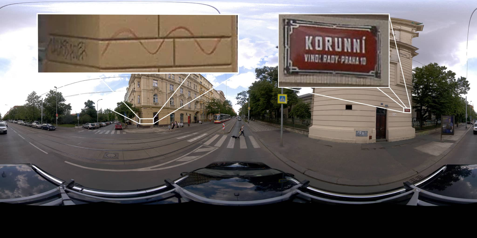
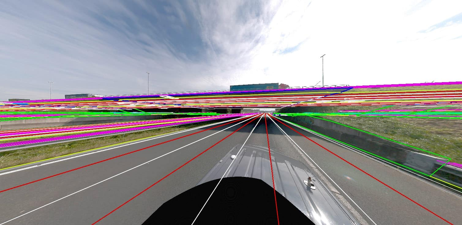
Next on the map is Prague, where Mosaic collaborated with VFX studio Scanline during the pre-production of the blockbuster film “The Gray Man.” Bryan Grill, a renowned visual effects supervisor, was impressed by Mosaic’s capabilities in data capture, leading to the use of Mosaic’s mobile mapping technology for street-level data in the film.

This underscores how Mosaic’s technology streamlined data capture for large-scale 3D models, offering efficiency and cost-effectiveness. Bryan Grill’s positive outlook on the future of this technology in VFX and gaming emphasizes Mosaic’s potential impact across industries. Jeffrey Martin, Mosaic CEO, outlines the versatility of their technology. He positions Mosaic as a leader in providing high-quality 3D asset creation systems. He emphasizes its potential across various industries, including TV/film production, VFX, video games, surveying, BIM, asset inspection, telecommunications, and infrastructure inspection. This positions Mosaic as a leading provider of a fast, user-friendly, and high-quality system for large-scale 3D asset creation.
Scandinavia – Field – Municipality mobile mapping
Meanwhile, let’s head to Scandinavia! Meet Field, a leading geospatial data collection company formed after the merger of KVS Technologies and Oslo-based Terratec. Field faced challenges with image quality using their previous camera, which therefore led them to seek higher resolution and improved quality. Mosaic became their solution, providing the Mosaic 51, Mosaic X, and Mosaic Viking cameras.
Field’s collaboration with Mosaic resulted in even more of a competitive edge. In doing so, this enabled them to meet customer demands for higher resolution imagery. The article highlights the successful partnership, showcasing how Mosaic’s cameras empower efficient remote viewing of road conditions and infrastructure. Field’s testimony underscores Mosaic’s commitment to delivering promised solutions and contributing to their success in the geospatial data collection market.
Florida, USA – SiteTour360 – Post disaster mapping
Moving to Florida, the article features SiteTour360, a company specializing in post-disaster mapping, particularly after Hurricane Ian. SiteTour360 utilized Mosaic’s cameras to collect 360-degree ground-level imagery for locations affected by the hurricane.
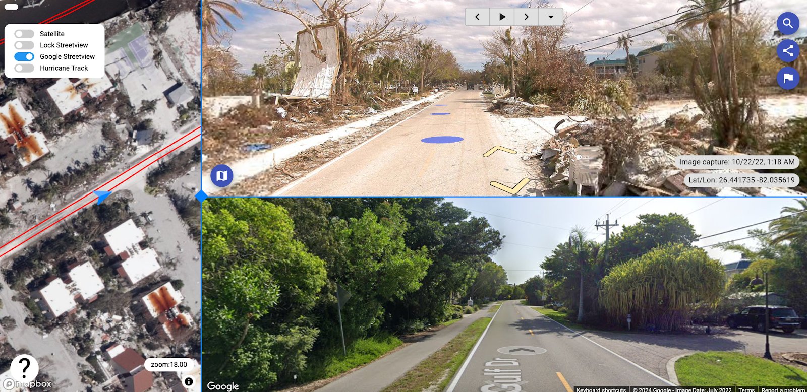
The project, funded by various organizations, demonstrates the practical application of Mosaic’s technology in post-disaster scenarios. The article provides insights into the comparison tool developed by SiteTour360, allowing users to view before-and-after images for comprehensive and interactive mapping. Mosaic’s role in supporting disaster response efforts is highlighted, emphasizing the significance of their technology in challenging scenarios.
California & Florida, USA – WGI – Road infrastructure surveying
In California and Florida, Mosaic made its mark through collaboration with WGI’s Geospatial Team. The acquisition of the Mosaic 51, a cutting-edge 360º camera setup, enhanced WGI’s mobile LiDAR collection capabilities.
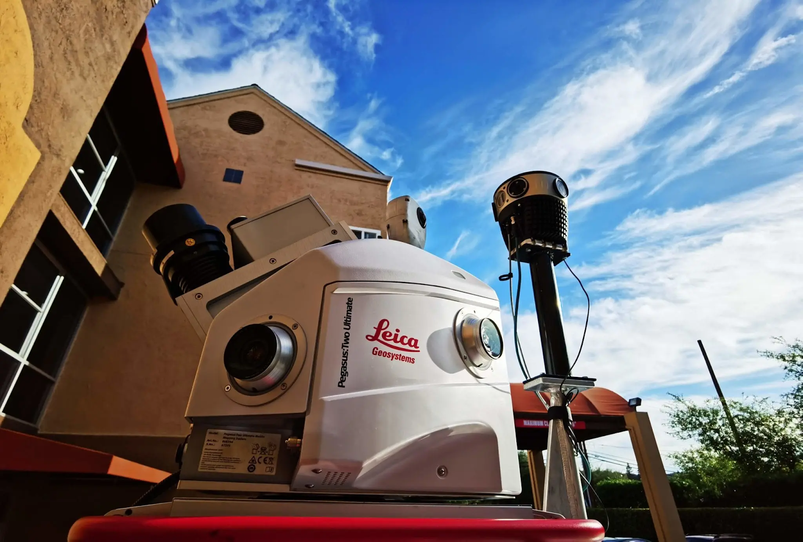
This emphasizes how Mosaic’s camera not only captures higher-resolution imagery but also optimizes images on-the-fly for brightness, contrast, and color balance. The Geospatial Team at WGI utilizes Mosaic’s technology to texturize 3D models, augment LiDAR-derived point clouds, as well as produce dense point clouds for object extraction. WGI’s history as a leader in land surveying technology further validates the benefits of Mosaic’s 72 Megapixel Spherical Camera System in providing high-quality data efficiently and cost-effectively.
Utah, USA – Sevier County rural road mapping
The journey takes us to Utah, USA, where the Sevier County Road Department engaged in rural road mapping with Mosaic’s technology. Pamela Blackmore, a GIS Specialist, expressed gratitude for Mosaic’s support in implementing the Mosaic 51 for 360-degree imaging.
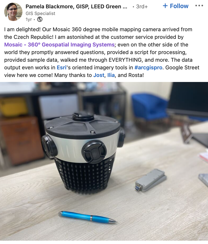
Pamela’s endorsement of the Mosaic 51 and Sevier County’s advancements in road mapping illustrate the practical applications of Mosaic’s geospatial imaging solutions. This showcases how Mosaic’s technology contributes to the GIS efforts of local authorities, then highlights the versatility of their cameras in diverse geographical settings. Watch the video case on our YouTube:
Explore the full playlist to discover more testimonials.
Singapore, USA, Europe – greehill – Green space management
In Singapore, USA, and Europe, Mosaic collaborated with greehill, a tech company specializing in green space management and city planning. Greehill successfully integrated Mosaic X camera systems with RIEGL mobile laser scanners to enhance their urban forest scanning system.
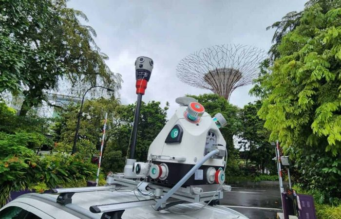
This shows how Mosaic’s cameras contribute to the accuracy and resolution of Greehill’s urban forest scanning system. The integration of 360-degree imagery and LiDAR technology showcases the synergy between Mosaic and Greehill in providing precise insights for green space management. The positive feedback from Mosaic CEO Jeffrey Martin and the alignment of both companies as pioneers in their fields underline the potential of Mosaic’s technology in revolutionizing green area management.

Check out this video highlighting the cool collaboration between Mosaic’s advanced hardware and greehill’s innovative software capabilities.
Morocco – Geomatic/Mapersive – Urban Planning
The journey continues to Morocco, where Mapersive, a SaaS solution, collaborates with Geomatic, a prominent GIS company. Mapersive sought to revolutionize geospatial data extraction and visualization for urban planning, relying on Mosaic’s 360º camera system, Mosaic 51.
This outlines Mapersive’s challenges in acquiring up-to-date and high-quality geospatial data, leading them to Mosaic’s technology. The implementation of Mosaic 51 resulted in significant improvements, including time efficiency, enhanced data quality, and accurate urban mapping. The positive feedback from end-users and stakeholders underscores the efficiency, ease of use, and accuracy enabled by Mosaic 51, positioning it as a crucial tool for future projects.
Michigan – Midwest Energy & Communications – Innovative utility mapping
In Michigan, Midwest Energy & Communications explored innovative utility mapping with Mosaic X Cameras. Going beyond the constraints of external sources and Google Street View (GSV), Midwest charted a new course to enhance infrastructure planning and maintenance, particularly for their fiber internet services. The decision to adopt Mosaic X cameras was fueled by their robustness, high-speed capture capability, and suitability for rural environments.
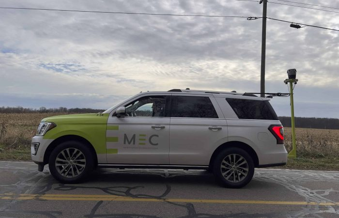
This transformative implementation yielded significant benefits, including improved safety, streamlined data collection, and enhanced collaboration across departments. Midwest’s journey continues as they plan to leverage Mosaic X cameras for expanding fiber internet services, solidifying their commitment to a data-driven approach in community-based utility services.
Netherlands – Kavel 10 – Utilizing imagery and RIEGL LiDAR for engineering data processing
Looking for innovative solutions in engineering data processing, Kavel 10 found a transformative ally in the Mosaic X camera system. The case study delves into Kavel 10’s journey, beginning with the challenge of transitioning from previous panoramic cameras due to limitations in resolution, rolling shutters, and user interfaces. The Mosaic X, acquired in May 2023, stood out with its compact standalone design, internal storage, web interface, stability, and reliability, addressing the inefficiencies of Kavel 10’s former systems.
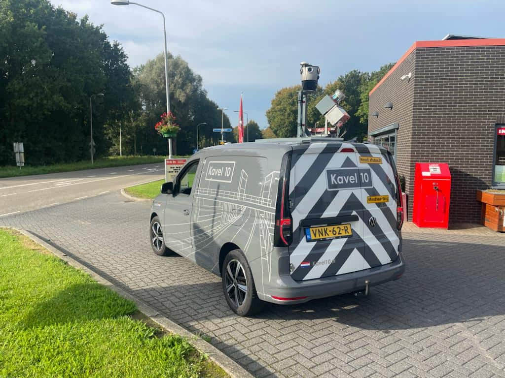
Highlighting the benefits of the Mosaic X camera, the case study showcases its unparalleled stability, cost-effectiveness, and user-friendly interface. Kavel 10’s extensive usage of the camera in engineering projects, including capturing street-level imagery, overlays of panoramas and CAD linework, and the colorization of point clouds with RIEGL LiDAR, exemplifies the camera’s efficiency and high-resolution capabilities. The system’s impact is reflected in significant man-hour savings, ease of use for drivers, and efficient support from Mosaic’s customer service. The case study concludes by underscoring Kavel 10’s strategic investment in the Mosaic X camera system, positioning them for future success and continued growth in the engineering sector.
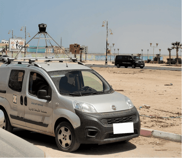
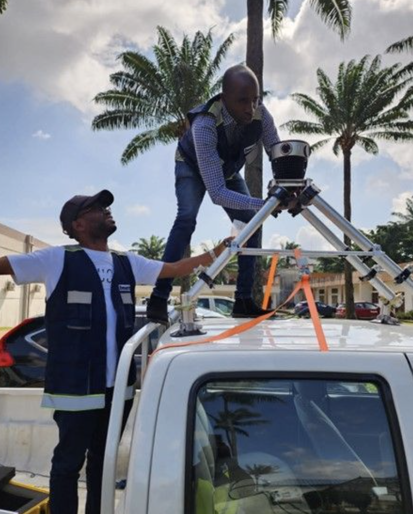
Abidjan – PLACE – Detailed urban imagery
Mosaic’s collaboration with BNETD in Abidjan, showcases the use of Mosaic’s geospatial imaging cameras, the Mosaic 51 for detailed mapping in African urban areas. The article emphasizes the importance of high-resolution street imagery captured at street level for mapping built and natural environments. The collaboration between Mosaic and BNETD highlights the effectiveness of Mosaic’s geospatial imaging technology in capturing intricate urban details.
The article underscores the significance of these images for mapping purposes, especially in the region. Additionally, it emphasizes the collaborative efforts between Mosaic and its client to achieve successful data collection and detailed urban imagery.
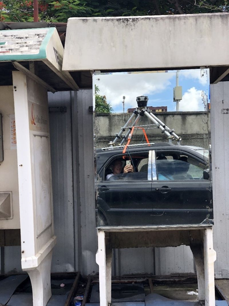
Colombia – Dymaxion – Electrical grid and road inspection
Next, the journey takes us to Colombia. Here, Dymaxion S.A.S., an engineering company, effectively utilized the Mosaic 51 for two major projects – electrical grid inspection and road inspection.
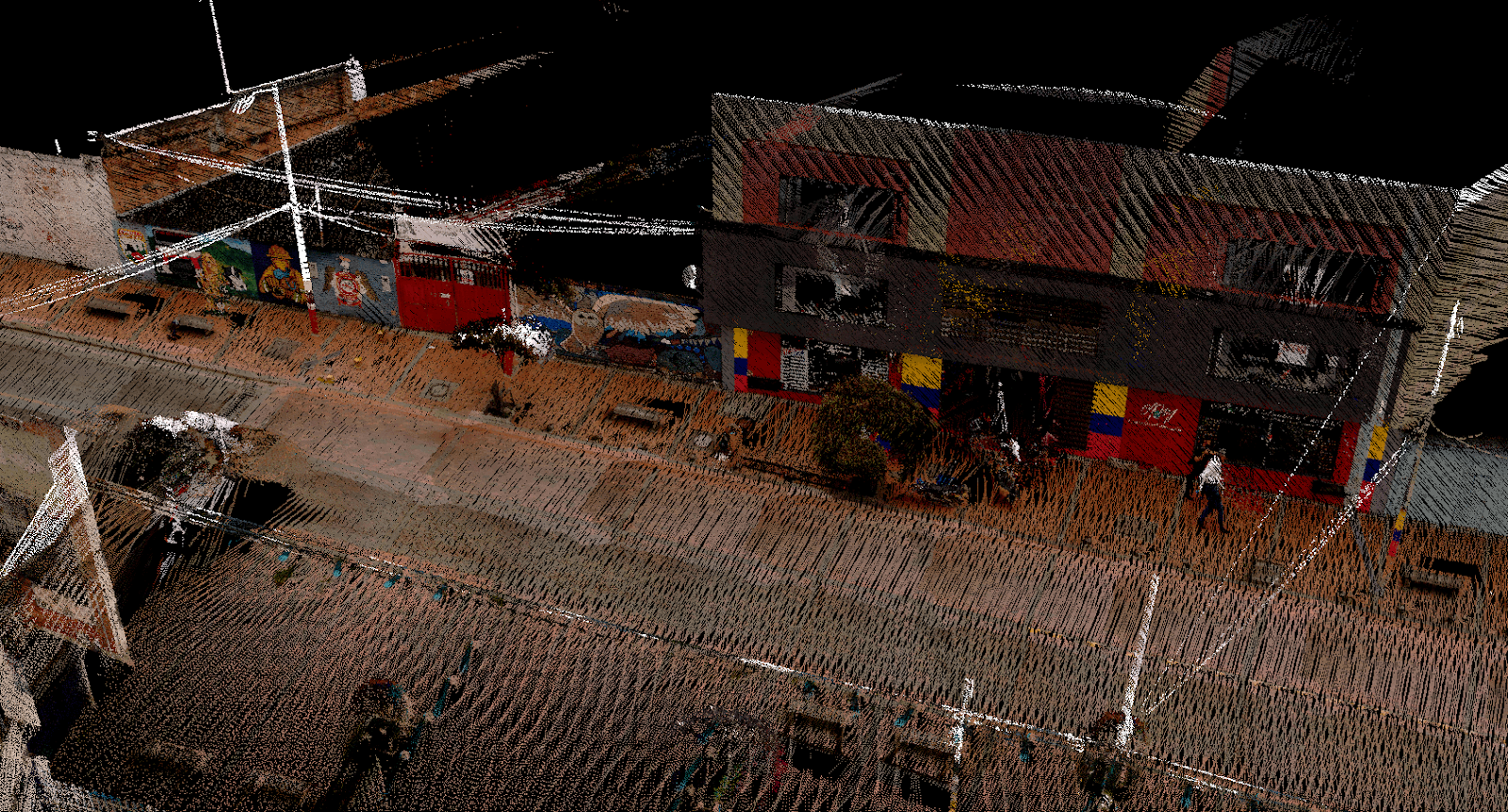
This highlights Dymaxion’s challenges in mapping and collecting detailed information about power lines covering extensive distances. Mosaic 51’s contribution to creating digital twins of the network components, facilitating efficient maintenance planning, underscores its role in enhancing infrastructure projects. The article also showcases Dymaxion’s successful extension of Mosaic 51 to inspect roads, demonstrating its robust performance in challenging weather conditions.
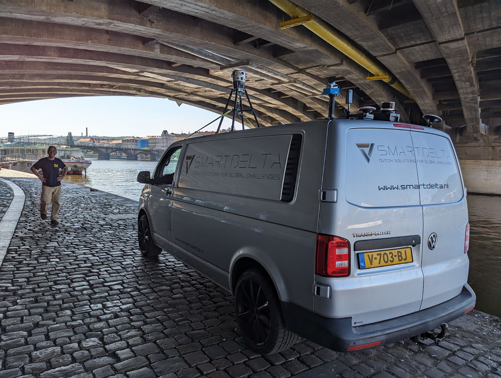
Prague – SmartDelta – Mobile mapping software integration
Lastly, the journey concludes in Prague, where Mosaic collaborates with SmartDelta, a pioneer in mobile mapping software. The aim was to integrate Mosaic’s 360º Camera Systems with SmartDelta’s Mobile Mapping Software, resulting in a groundbreaking fusion of data collection capabilities.
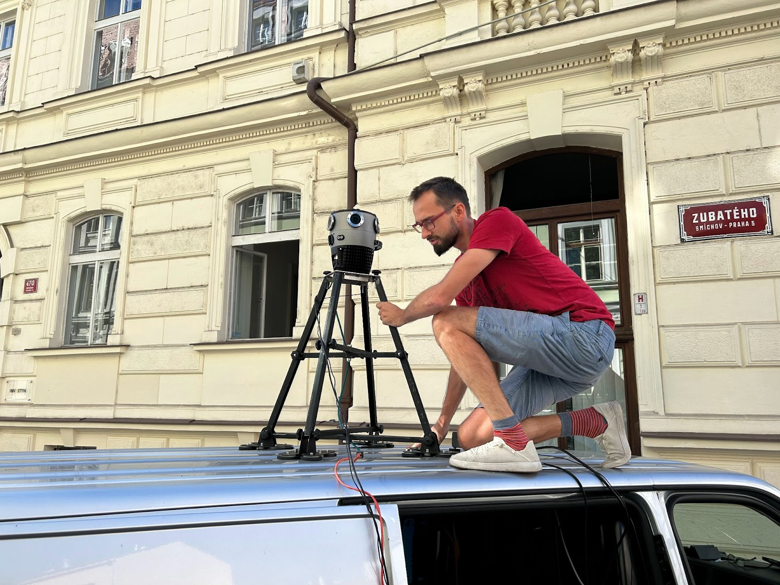
This details the dual-purpose cameras of Mosaic’s 360º Camera Systems and their seamless integration with industry-standard sensors. The testing ground in Prague showcases the collaborative efforts, with a vehicle equipped with advanced sensors collecting data with accuracy and stability. The article emphasizes the promise of seamless integration in mobile mapping applications, signaling a future where data collection and processing are not only efficient but transformative.
Mobile Mapping and Street View Data: Impact Beyond Navigation
Beyond specific case studies, the article broadens the perspective to explore the extensive applications and impact of mobile mapping and street view data globally. Lynn Puzzo, the Director of Sales & Marketing at Mosaic, articulates how mobile mapping goes beyond navigation, influencing urban planning, emergency response, transportation safety, environmental conservation, and more.
This delves into the advancements in mobile mapping, highlighting its role in shaping and enhancing various aspects of our lives and communities. It underscores Mosaic’s contribution to the transformative impact of mobile mapping data, positioning the company as a key player in the evolving landscape of geospatial data acquisition.
Conclusion
“Where in the World is Mosaic?” This collection of case studies showcases the global footprint of Mosaic’s transformative technology. From telecom surveying in the UK to VFX collaboration in Prague and rural road mapping in Utah, Mosaic’s 360º mobile mapping cameras have made a substantial impact across diverse industries and geographical locations.
The success stories of Catsurveys, Scanline, Field, SiteTour360, WGI, Sevier County, greehill, Geomatic, Dymaxion, and the collaboration with SmartDelta in Prague paint a comprehensive picture of Mosaic’s versatility. The positive outcomes experienced by these companies across different sectors underscore the efficiency, cost-effectiveness, and transformative potential of Mosaic’s advanced imaging solutions.
As the geospatial data acquisition landscape continues to evolve, Mosaic’s commitment to providing cutting-edge technology for diverse applications remains unwavering. The case studies presented here are not just a testament to the success of Mosaic’s cameras but also a glimpse into the future, where innovative technology reshapes how we capture, analyze, and utilize spatial data globally. The journey of Mosaic across the world is not just a geographical exploration but a narrative of technological excellence, industry collaboration, and real-world impact. Discover more success stories from various industries on our special page.
Contact our team today to learn more!


